

 Foray into Val Pellice, vallée vaudoise in Piémont


• Self-guided tour, 4 days
• Difficult circuit, Children above 8-10 years old
• Altitude : 1760 to 2523 m
• Departure and arrival in Le Roux
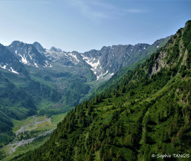
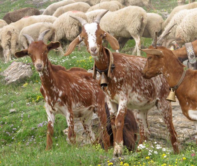
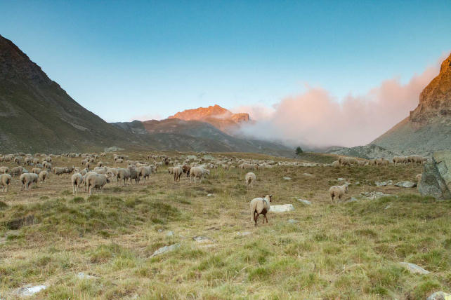
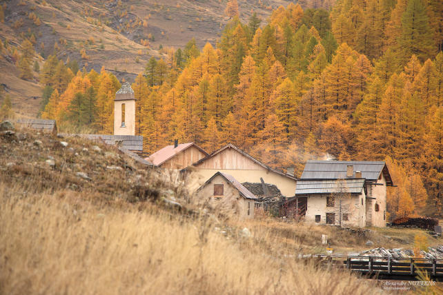
Discover a Piedmont alpine hamlet in the upper Vaud valley of Val Pellice. Leaving from Monta in the Guil valley, where the mountain pastures are wide and open to the horizon, you will reach the Lacroix pass and after crossing it you will be impressed by the contrast. The steep path plunges towards the pasture and the deep Piedmont valley. You then arrive at the first sheepfolds of Ciabot del Pra, where summer life continues with the ringing of bells of cows and sheeps. The welcome is that of always, simple, discreet, smiling. Travel in space, travel in time, you are in Val Pellice, in this mountain which has never abandoned the bond woven between man and the earth.
Considering the important distances and elevations, this route, a real journey in a rural and traditional mountain environment, is aimed at experienced hikers.
Possibility to make the circuit in 5 days, with a day of "relaxation" to discover the upper Val Pellice on the third day.
- Stages -
Day 1 : Le Roux (1760 m) - La Monta (1670 m) (Gîte or Bivouac)
Elevation gain : 320 m - Elevation loss : 380 m - Distance : 9 km - Walking time : 3 hrs
You leave Le Roux via the GR58 variant and cross the Bouchet torrent before joining the forest track which rises gradually in the Brune wood to arrive at Fusteit (2010 m) on the Abriès ski slopes. There, you join the GR58 which descends on Ristolas passing the pond of Moussou (1920 m). Arrived at the bottom of the valley, you take the elegant wooden structure bridge which spans the Guil torrent, you follow the GR58 which crosses Ristolas and you follow the left bank of the torrent to La Monta. Accommodation in a gîte or bivouac.
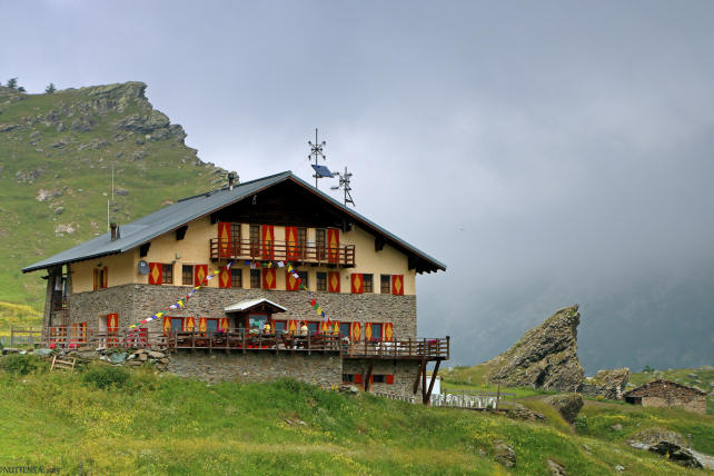
Day 2 : La Monta (1670 m) - Col Lacroix (2300 m) - Ciabot del Pra (1742 m) (Gîte or Bivouac)
Elevation gain : 630 m - Elevation loss : 560 m - Distance : 5,4 km - Walking time : 4 hrs
Take the variant of the GR58 which rises in the larch of the Bois des Hauts Gays after crossing the torrent of the Battle. The forest gives way to the alpine lawns of the alpine pastures and after passing the ruins of the Napoleon refuge at an altitude of 2250 m, you cross the Col Lacroix. There, change of atmosphere and decor, it is finished with the open mountain pastures of the Guil valley. You are off for a long descent into Val Pellice on the well-maintained path with countless switchbacks that takes you to the alpine hamlet of Ciabot del Pra, lulled by the ringing of bells. Arrived on this plateau of altitude, either you enjoy the warm welcome of the family inn of Ciabota, or Refuge Jervis or you install your camp under the Mélézin (larch trees).
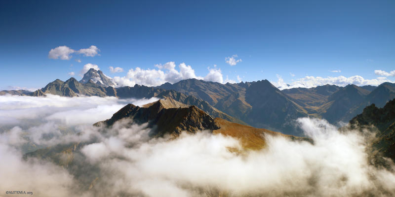
Day 3 : Ciabot del Pra (1742 m) - Col d'Urine (2523 m) - Under the Col (2330 m) (Bivouac)
Elevation gain : 780 m - Elevation loss : 195 m - Distance : 5 km - Walking time : 4 hrs
Take the GR58 which sinks into the deep valley of Urine, towards the eponymous pass. At 2059 m altitude, leave the path on the right which goes towards the alpine chalets of Alpe Crosenna and continue your ascent in the valley. Once you have crossed the pass, you are once again in the typical open environment of the Queyras valleys where larch, flowered alpine lawn and Rhododendron bushes share the space... Win the first flats and set up your bivouac there.
Day 4 : Under the col d'Urine (2330 m) - Valpréveyre (1850 m) - Le Roux (1760 m)
Elevation loss : 570 m - Distance : 6 km - Walking time : 3 hrs
To reach the Bouchet valley, follow the path that descends steadily into the Mélézin, on the right bank of the Urine stream. You reach the hamlet of Valpréveyre, uninhabited in winter and which has become a summer pasture site, after crossing the torrent on a footbridge (beware, it can be slippery). At the exit of the hamlet, take the tarmac road then the balcony path which goes to the right and which brings you back to Le Roux via Les Mounets.
- Practical information -
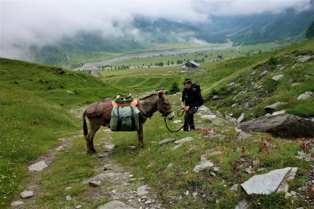
The donkeys
* They are intended to carry your luggage. Gregarious animals, they will appreciate your company but also that of their fellows and beyond 3 people, it would be better to travel with 2 donkeys for the comfort and well-being of all.
* Their equipment : Each donkey is equipped with a halter, a lunge, a wooden packsaddle and 2 large bags hung on each side of the packsaddle. A donkey can carry 30 kg, that is the luggage of 2 to 3 hikers.
The load must be perfectly balanced (15 kg on each side). Above the animal, only light loads (mattresses, etc.) can be placed, in order to avoid exhausting or unbalancing it.
* Donkey food and night : in most lodges, a park is set up for donkeys and we provide the necessary equipment to tie them up at night.
Preparation for your hike
We advise you to arrive at Le Roux the day before your departure in order to get to know and prepare your hike (study of the route). Accommodation is possible at the Cassu gite, opposite our base camp.
On the morning of departure, allow at least one hour for the preparation of the donkey and the organization of luggage.
Period
This hike can be done from July to October. From 15 September, some accommodations (gîtes, refuges, camping) may be closed.
IGN map
This circuit appears on the IGN map (1/25000 th) 3637OT - Mont Viso, St Véran, Aiguilles, Queyras.
Accommodation
For this hike, possibility of accommodation in a gîte / refuge or bivouac under tent (equipment not provided).
http://www.ciabota.it
https://www.jervis.it
https://www.montourduqueyras.fr
Supplies
You must arrive with the necessary equipment for the duration of your stay. For the water, bring a water bottle per person and Micropur tablets.
Your luggage
In the Hautes-Alpes the climate is very contrasted: the heat of full sun during the day and surprising freshness at night.
So plan :
* walking shoes and light shoes for the evening,
* a change of clothes, a warm sweater, a hat for the sun,
* rainwear (waterproof poncho),
* water bottle, flashlight, notebook, pen, lighter, knife, string,
* pharmacy, protective cream and sunglasses,
* plastic bags to wrap the things in the bag (very effective in case of rain) and to bring your trash down,
* stove and kitchen equipment, tent and sleeping bag (if camping)
Your dog
According to regulations, your dog can accompany you on the trails of the Queyras Regional Natural Park provided that it is kept on a leash. After a period of adaptation and mutual observation, he will cohabit with the donkeys. However, it must be taken into account that this does not simplify the organization of your hike because it is sometimes difficult to manage everything at the same time: the donkey or donkeys, the children, the luggage, the map to follow the right path and... the dog ! Especially since it is sometimes necessary to keep away from the donkey with the dog on a leash and that there can be problems with the dogs that protect the flocks of sheep in the pastures. Dogs cannot sleep in the accommodation and, in general, a shelter is provided for them outside. Remember to let us know if you plan to hike with a dog.
Your car and various equipment
During your hike, your car stays in one of the car parks in the hamlet of Roux d'Abriès.
- Prices and contact -
It includes the rental of a donkey equipped with a packsaddle, a halter, a lunge and two saddlebags.
Your accommodation and the possible transport of donkeys must be paid in addition.
4 days with 1 donkey : € 248
For more information :
06 82 48 09 99 or anerousin@orange.fr
To book this stay, please download and complete our rental contract and attach a deposit of 30% of the amount.
Download a printable version of this hike (Pdf)