

 Circuit of the 3 passes, between France and Piedmont


• Self-guided tour, 6 days
• Difficult circuit, Children above 8-10 years old
• Altitude : de 1760 to 2800 m
• Departure and arrival in Le Roux
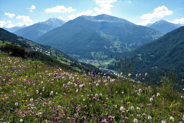
This is a timeless initiatory journey to discover the upper Piedmont valley of Val Thuras and that of the Cervières valley in Briançonnais, by crossing the high passes of Thures, Chabaud and Péas. The great Pic de Rochebrune, emblematic summit of Queyras, will be your focal point for almost the entire route. You will be seduced by the calm and serenity of the long Piedmont valley of Val Thuras which, because of its remoteness, has remained away from human traffic and contrasts in a striking way with the valley of the Cervières bottoms, dotted with alpine hamlets. The remains of military works from the last war, as well as the ruins of the martyred hamlet of Rhuilles, bear witness to a sometimes hectic past in these high Alpine valleys, where agriculture is struggling to maintain itself.
In view of the significant distances and elevation differences, this circuit, a real journey in a rural and traditional mountain environment, is aimed at experienced hikers.
Possibility of carrying out this circuit in 7 days, with a day of "relaxation" in the valley of the Funds of Cervières.
- Stages -
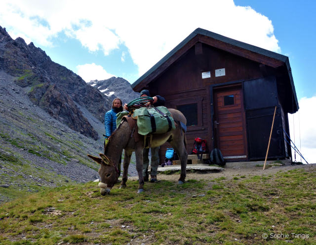
Day 1 : Le Roux (1760 m) - Col des Thures (2800 m) - Bivouac Tornior (2510 m) (cabin sleeps 8)
Elevation gain : 1040 m - Elevation loss : 290 m - Distance : 8 km - Walking time : 6 hrs
Leave Le Roux in the direction of the Col des Thures by the "GR58 variant" which runs along the torrent at the foot of the Mamezel wood, a paradise for black grouse, variable hares and speckled nutcrackers. The slope straightens up under the hamlet of Montette and you cross a footbridge before continuing on the left, to join the Thures path, avoiding small footbridges. You reach the upper part of the alpine pasture by following the path which climbs up the steep slope, up to the pass which you reach after several hours of walking. And there, change of scenery and change of scenery guaranteed, you leave France to discover the open mountain pastures of Val Thuras, deep and remote valley of the foothills. As the schist marls make the descent behind the pass a little slippery, follow the path which starts diagonally to the right and which joins the main path below along the torrent. Arriving at the sleep-8 cabin, built in honor of Andréa Tornior, set up your camp as you wish.
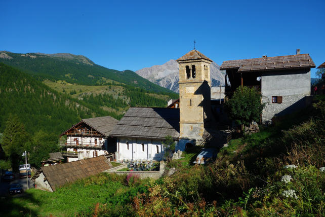
Day 2 : Bivouac Tornior (2510 m) - Rhuilles (1665 m) - Thures (1650 m) (Gîte or Bivouac)
Elevation gain : faible - Elevation loss : 860 m - Distance : 11 km - Walking time : 4hrs
Shortly after departure, you leave the remains of the imposing military casemates, hidden on the rocks, on your left hand. By a long journey in this deep valley which has never abandoned the bond woven between man and his land, you arrive at the hamlet of Ruilles, whose memorial located near the bridge attests the fateful fate. The typical hamlet of Thures will seduce you with its traditional architecture combining wood and stone and you can enjoy the warm and attentive welcome of the owners of the Fontana gîte (delicious local cuisine).
If you opt for the bivouac, two possibilities: camping near the village of Thures or else in the summer village of Chabaud (1915 m) which you reach from Rhuilles by taking the path to the left which leads to Col Chabaud after crossing the torrent.
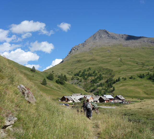
Day 3 : Thures (1650 m) - Col Chabaud (2215m) - Le Bourget (1880m) - Fonts de Cervières (2040m) (Gîte or Bivouac)
Elevation gain : 725 m - Elevation loss : 335 m - Distance : 13,5 km - Walking time : 5 hrs
From Thures, retrace your steps and at Rhuilles, take the path on the right which crosses the torrent and takes you to the Chabaud pass, passing by the eponymous village. You reach the high mountain pastures before switching to France on the remarkable valley of the Fonds de Cervières, dominated by the Pic de Rochebrune and its limestone towers. From the pass, descend into the pasture and reach the bottom of the Cerveyrette valley along the well-kept mowing meadows, witnesses of a very present agricultural activity. Then go along the torrent to the hamlet of Fonts where you will have the possibility of bivouacking or staying at the gîte run by the Faure family, renowned for its invigorating cuisine.
Day 4 : Fonts de Cervières (2040m) - Col Péas (2629m) - Souliers (1820m) (Gîte ou Bivouac)
Elevation gain : 589 m - Elevation loss : 809 m - Distance : 9 km - Walking time : 5 hrs
Take the GR58 which rises along the Cerveyrette towards the Col de Péas, in the mountain pastures dominated by the Pic de Rochebrune and its vast scree. Then switch to the Péas valley where you leave the old asbestos mine on your left and find the forest cover of the mountain floor before reaching the hamlet of Souliers. Possibility to stay in a gîte or bivouac or in a guest room ("Les Oules").
Day 5 : Souliers (1820m) - Meyriès (1700m) - Aiguilles (1470m) (Gîte, camping or Bivouac)
Elevation gain : faible - Elevation loss : 350 m - Distance : 10,5 km - Walking time : 5 hrs
Leave Souliers by the tarmac road and in a hairpin turn take the path on the left towards Meyriès. After crossing the Péas torrent, the path follows the old canal and joins the tarmac road which leads to the hamlet of Meyriès. Cross it on the way up and take on the right the track ("GR58 variant") on which you walk peacefully with donkey's steps before finding civilization in the village of Aiguilles. Accommodation in a gîte, campsite or bivouac.
Day 6 : Aiguilles (1470m) - Les Sagnières (1780 m) - Abriès (1550m) - Le Roux (1760m)
Elevation gain : 600 m - Elevation loss : 300 m - Distance : 12 km - Walking time : 5 h
Join the forest track on the left bank of the Guil which climbs towards "la Juanal". Find the upper track, follow it east towards "Sagnières" and enjoy the pleasant journey through the larch of the Marrassan forest. Then take the track down to Abriès on the left. Cross the village and take the road towards Le Roux, then recover the GR58 on the right which rises in the forest. Then, leave the GR in the first hairpin turn around 1800 m above sea level and descend to the left by the path which joins the track below. Cross the stream and join the Roux by the departure route.
- Practical information -
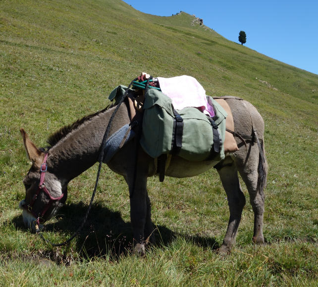
The donkeys
* They are intended to carry your luggage. Gregarious animals, they will appreciate your company but also that of their fellows and beyond 3 people, it would be better to travel with 2 donkeys for the comfort and well-being of all.
* Their equipment : Each donkey is equipped with a halter, a lunge, a wooden packsaddle and 2 large bags hung on each side of the packsaddle. A donkey can carry 30 kg, that is the luggage of 2 to 3 hikers.
The load must be perfectly balanced (15 kg on each side). Above the animal, only light loads (mattresses, etc.) can be placed, in order to avoid exhausting or unbalancing it.
* Donkey food and night : in most lodges, a park is set up for donkeys and we provide the necessary equipment to tie them up at night.
Preparation for your hike
We advise you to arrive at Le Roux the day before your departure in order to get to know and prepare your hike (study of the route). Accommodation is possible at the Cassu gite, opposite our base camp.
On the morning of departure, allow at least one hour for the preparation of the donkey and the organization of luggage.
Period
This hike can be done from July to October. From 15 September, some accommodations (gîtes, refuges, camping) may be closed.
IGN map
This circuit appears on
IGN map (1/25000 th) : 3637 OT - Mont Viso, St Véran, Aiguilles, Queyras and 3537 ET - Guillestre, Vars, Risoul
Fraternali Editore (1/25000 th) - Alta Valle Susa, Alta Val Chisone (2)
Accommodation
For this hike, possibility of accommodation in a gîte / refuge or bivouac under tent (equipment not provided).
https://www.montourduqueyras.fr
http://www.rifugiothures.it
Supplies
You must arrive with the necessary equipment for the duration of your stay. For the water, bring a water bottle per person and Micropur tablets.
Your luggage
In the Hautes-Alpes the climate is very contrasted: the heat of full sun during the day and surprising freshness at night.
So plan :
* walking shoes and light shoes for the evening,
* a change of clothes, a warm sweater, a hat for the sun,
* rainwear (waterproof poncho),
* water bottle, flashlight, notebook, pen, lighter, knife, string,
* pharmacy, protective cream and sunglasses,
* plastic bags to wrap the things in the bag (very effective in case of rain) and to bring your trash down,
* stove and kitchen equipment, tent and sleeping bag (if camping)
Your dog
According to regulations, your dog can accompany you on the trails of the Queyras Regional Natural Park provided that it is kept on a leash. After a period of adaptation and mutual observation, he will cohabit with the donkeys. However, it must be taken into account that this does not simplify the organization of your hike because it is sometimes difficult to manage everything at the same time: the donkey or donkeys, the children, the luggage, the map to follow the right path and... the dog ! Especially since it is sometimes necessary to keep away from the donkey with the dog on a leash and that there can be problems with the dogs that protect the flocks of sheep in the pastures. Dogs cannot sleep in the accommodation and, in general, a shelter is provided for them outside. Remember to let us know if you plan to hike with a dog.
Your car and various equipment
During your hike, your car stays in one of the car parks in the hamlet of Roux d'Abriès.
- Prices and contact -
It includes the rental of a donkey equipped with a packsaddle, a halter, a lunge and two saddlebags.
Your accommodation and the possible transport of donkeys must be paid in addition.
6 days with 1 donkey : € 372
7 days with 1 donkey : € 427
For more information :
06 82 48 09 99 or anerousin@orange.fr
To book this stay, please download and complete our rental contract and attach a deposit of 30% of the amount.
Download a printable version of this hike (Pdf)