

 Between Guil valley and Aigues valley, through St Véran


• Self-guided tour, 6 days
• Difficult circuit, Children above 8-10 years old
• Altitude : 1760 to 2884 m
• Departure and arrival in Le Roux
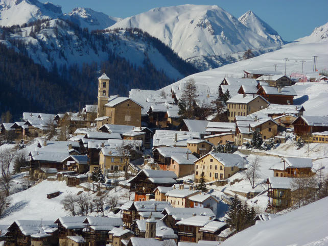
Leaving from the Guil valley, this long-distance hike takes you to discover the Bouchouse valley with its high-altitude lakes (Egorgéou, Foréant), dominated by the Pain de Sucre peaking at 3208 m. At the Vieux pass, you switch to the valleys of the Aigues, mineral kingdoms appreciated by the pickers of genepi and biotopes par excellence of the ptarmigan and the niverolles. You then discover StVéran, the highest inhabited village in Europe, at an altitude of 2040 m and you complete this beautiful loop by joining the Guil valley in Aiguilles.
Considering the significant distances and elevation differences, this route, a real journey in a high mountain environment, is aimed at experienced hikers.
Possibility of carrying out this circuit in 7 days, with a day of "relaxation" in the Cirque de la Blanche, at the foot of the Tête des Toillies.
- Stages -
Day 1 : Le Roux (1760 m) - La Monta (1670 m) (gîte ou bivouac)
Elevation gain : 320 m - Elevation loss : 380 m - Distance : 9 km - Walking time : 3 hrs
You leave Le Roux via the GR58 variant and cross the Bouchet torrent before joining the forest track which rises gradually in the Brune wood to arrive at Fusteit (2010 m) on the Abriès ski slopes. There, you join the GR58 which descends on Ristolas passing through the pond of Moussou (1920 m). Arrived at the bottom of the valley, you take the elegant wooden structure bridge which spans the Guil torrent, you follow the GR58 which crosses Ristolas and you follow the left bank of the torrent to La Monta. Accommodation in a gîte or bivouac.
Day 2 : La Monta (1670 m) - Lac Foréant (2610 m) (Bivouac)
Elevation gain : 940 m - Distance : 7,5 km - Walking time : 4 hrs
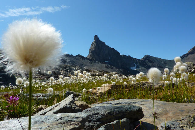
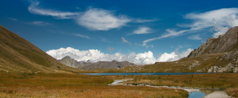
Follow the GR58 which takes you to the entrance to the Bouchouse valley and rises in the Mélézin to the Chalets de la Médille. Be careful because you may have the opportunity to observe the ibexes that roam the austere rock walls that overlook the valley. The path continues to rise in this majestic setting with contrasting relief, where the forest gives way to the mineral and finally here is Lake Egorgéou, with its hidden neighbor Lake Baricle, real jewels huddled at the foot of the impressive Crête de la Sharp. Continue to Lac Foréant, dominated by rocky ridges appreciated by genepi pickers, and set up camp there.
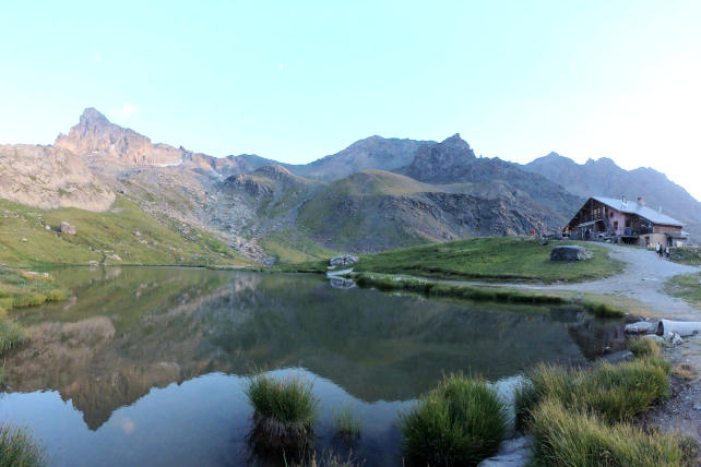
Day 3 : Lac Foréant (2610 m) - Col Vieux (2806 m) - sous Col Agnel (2700 m) - Col de Chamousiere (2884 m) - Col de St Véran (2844 m) - Refuge La Blanche (2499 m) (Gîte ou Bivouac)
Elevation gain : 380 m - Elevation loss : 493 m - Distance : 8,3 km - Walking time : 4 hrs
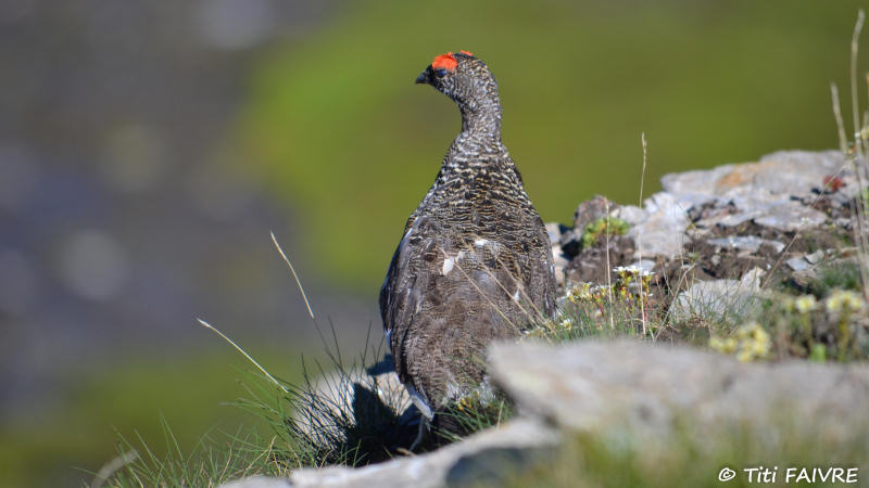
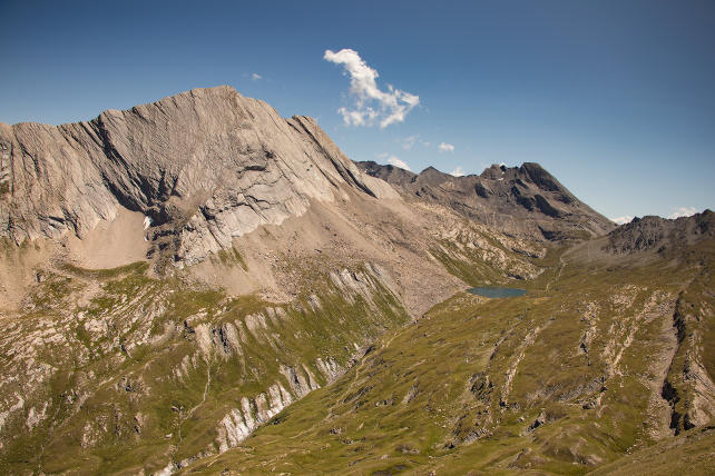
Take the GR58 and cross the Vieux pass, often swept by the winds, to switch to the Aigue Agnelle valley. Around 2730 m above sea level, follow the balcony path on the left which joins the Route Départementale 205 under the Agnel pass, where you can take a detour to admire the superb view which plunges into the Italian valley of Chianale. Continue on the GR58 and cross the Col de Chamoussière. You are now in the upper valley of the Aigue Blanche, the biotope par excellence of the ptarmigan and the niverolles. Take the balcony path on the left which leads to the St Véran pass then descend by the path which leads to the Blanche refuge. Accommodation at the refuge or bivouac.
Day 4 : La Blanche (2499 m) - St Véran (2040 m) - Pierre Grosse (1880 m) (Camping ou Bivouac)
Elevation gain : 60 m - Elevation loss : 680 m - Distance : 11 km - Walking time : 4 hrs
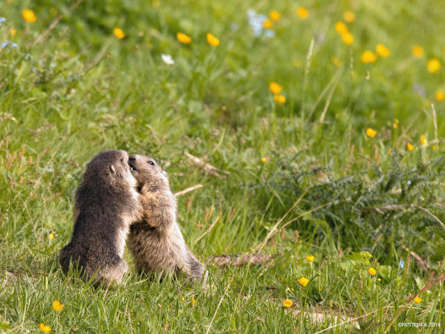
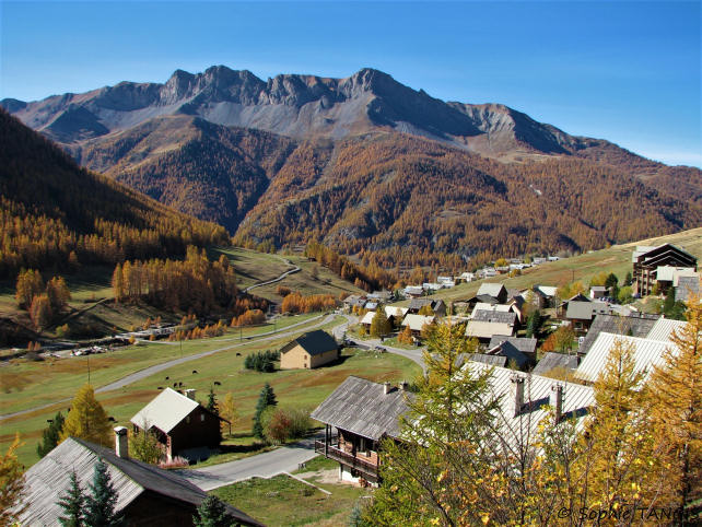
From the refuge, take the path that descends into the alpine pasture, a marmot paradise, passing by "la Moutière" and which joins the GR58 in the Cornivier torrent. Follow the path that passes under the old marble quarry and above the old copper mine, then join the Grand Canal at an altitude of 2330 m. Walk quietly at the donkey's pace, at the foot of the highest French astronomical observatory in Europe, located on the Pic de Château Renard (2930 m). Arrived on the ski slopes, leave the Grand Canal path and visit St Véran, where according to legend "the rooster pecks the stars". At the exit of the village, join the path to the Ste Marie Madeleine chapel and walk in the wood of Amoureux to Pierre Grosse. Camping or bivouac accommodation.
Day 5 : Pierre Grosse (1880 m) - Prats Hauts (1796 m) - Aiguilles (1460 m) (Gîte, camping ou Bivouac)
Elevation gain : faible - Elevation loss : 436 m - Distance : 10,5 km - Walking time : 3,5 hrs
Cross the hamlet of Pierre Grosse and take the path down to Molines. At 1889 m altitude, follow the path on the right which follows the Pierre Dimanche canal and which arrives at Prats Hauts. Cross the hamlet and take the path which passes near an oratory. In the Chanteloube forest around 1623 m above sea level, join the track which descends to the left towards the village of Aiguilles. Gîte, camping or bivouac accommodation.
Day 6 : Aiguilles (1470m) - Les Sagnières (1780 m) - Abriès (1550m) - Le Roux (1760m)
Elevation gain : 600 m - Elevation loss : 300 m - Distance : 12 km - Walking time : 5 hrs
Join the forest track on the left bank of the Guil which goes up to "la Juanal". Find the upper track, follow it east towards "Sagnières" and enjoy the pleasant journey through Mélézin of the Marrassan forest. Then take the track down to Abriès on the left. Cross the village and take the road towards Le Roux, then recover the GR58 on the right which rises in the forest. Then, leave the GR in the first hairpin around 1800 m above sea level and descend to the left by the path which joins the track below. Cross the stream and join the Roux by the departure route.
- Practical information -
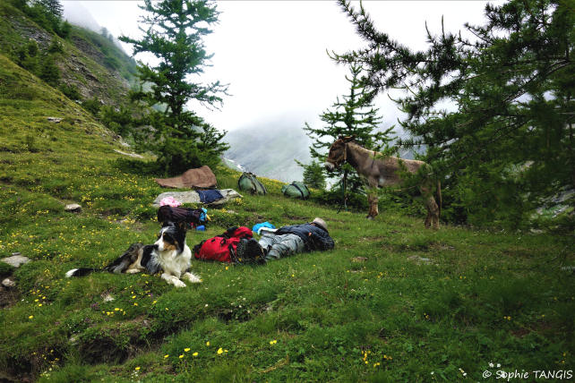
The donkeys
* They are intended to carry your luggage. Gregarious animals, they will appreciate your company but also that of their fellows and beyond 3 people, it would be better to travel with 2 donkeys for the comfort and well-being of all.
* Their equipment : Each donkey is equipped with a halter, a lunge, a wooden packsaddle and 2 large bags hung on each side of the packsaddle. A donkey can carry 30 kg, that is the luggage of 2 to 3 hikers.
The load must be perfectly balanced (15 kg on each side). Above the animal, only light loads (mattresses, etc.) can be placed, in order to avoid exhausting or unbalancing it.
* Donkey food and night : in most lodges, a park is set up for donkeys and we provide the necessary equipment to tie them up at night.
Preparation for your hike
We advise you to arrive at Le Roux the day before your departure in order to get to know and prepare your hike (study of the route). Accommodation is possible at the Cassu gite, opposite our base camp.
On the morning of departure, allow at least one hour for the preparation of the donkey and the organization of luggage.
Period
This hike can be done from July to October. From 15 September, some accommodations (gîtes, refuges, camping) may be closed.
IGN map
This circuit appears on the IGN map (1/25000 th) 3637OT - Mont Viso, St Véran, Aiguilles, Queyras.
Accommodation
For this hike, possibility of accommodation in a gîte / refuge or bivouac under tent (equipment not provided).
https://www.montourduqueyras.fr
Supplies
You must arrive with the necessary equipment for the duration of your stay. For the water, bring a water bottle per person and Micropur tablets.
Your luggage
In the Hautes-Alpes the climate is very contrasted: the heat of full sun during the day and surprising freshness at night.
So plan :
* walking shoes and light shoes for the evening,
* a change of clothes, a warm sweater, a hat for the sun,
* rainwear (waterproof poncho),
* water bottle, flashlight, notebook, pen, lighter, knife, string,
* pharmacy, protective cream and sunglasses,
* plastic bags to wrap the things in the bag (very effective in case of rain) and to bring your trash down,
* stove and kitchen equipment, tent and sleeping bag (if camping)
Your dog
According to regulations, your dog can accompany you on the trails of the Queyras Regional Natural Park provided that it is kept on a leash. After a period of adaptation and mutual observation, he will cohabit with the donkeys. However, it must be taken into account that this does not simplify the organization of your hike because it is sometimes difficult to manage everything at the same time: the donkey or donkeys, the children, the luggage, the map to follow the right path and... the dog ! Especially since it is sometimes necessary to keep away from the donkey with the dog on a leash and that there can be problems with the dogs that protect the flocks of sheep in the pastures. Dogs cannot sleep in the accommodation and, in general, a shelter is provided for them outside. Remember to let us know if you plan to hike with a dog.
Your car and various equipment
During your hike, your car stays in one of the car parks in the hamlet of Roux d'Abriès.
- Prices and contact -
It includes the rental of a donkey equipped with a packsaddle, a halter, a lunge and two saddlebags.
Your accommodation and the possible transport of donkeys must be paid in addition.
6 days with 1 donkey : € 372
7 days with 1 donkey : € 427
For more information :
06 82 48 09 99 or anerousin@orange.fr
To book this stay, please download and complete our rental contract and attach a deposit of 30% of the amount.
Download a printable version of this hike (Pdf)