

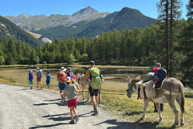
 Discovering the mountain hamlets and lakes of Queyras.


• Self-guided tour, 6 days - July/October
• Moderately difficult circuit , children from 8 years old
• Altitude from 1350 to 2487 m
• Departure and arrival at Le Roux
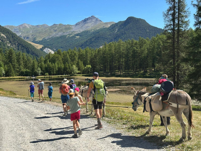
Explore the different villages and hamlets of Haut-Guil and Val d'Azur while passing by the two unmissable lakes of the Arvieux valley.
- Stages -
Day 1 : Le Roux (1760 m) – Abriès (1550 m) – Marassan Forest – Aiguilles (1450 m)
Elevation gain: 230 m / Elevation loss: 520 m
Distance: 10 km / Walking time: 5 h
Leave Le Roux via the GR58 towards Abriès, cross the Bouchet torrent to take a balcony path passing under the old hamlet of Le Cros and descending to Abriès. Then cross the village and the Guil and turn right towards Aiguillez via a shaded, balcony forest track. After passing the Gouret campsite and its beautiful lake, cross the Pas de l'Ours via the pedestrian route and you arrive at the village of Aiguilles, the beautiful American village, where your accommodation is located.
Accommodation at the Petite Auberge lodge, where a donkey park awaits you.
Day 2 : Aiguilles (1450 m) – Meyriès (1700 m) - Souliers (1820 m) (Gîte)
Elevation gain: 660 m / Elevation loss: 320 m / Distance: 10 km / Walking time: 5 h
Leave Aiguilles via the GR 58 trail towards Les Meyries. Along this beautiful panoramic sunny slope, you'll discover the foxtail milkvetch, which you won't see anywhere else in Queyras. Arriving at Le Rouet, stop at the Barbaraou cheese dairy, a picturesque place where you'll be welcomed directly into the stable in the heart of a 17th-century mountain chalet. You'll then head towards Fort Queyras, quickly turning right to join the Coste Bertrand forest trail. After seeing the donkeys watering in the small Péas stream, the trail joins a small, quiet road that leads to Souliers.
Accommodation at the Grand Rochebrune lodge where a donkey park awaits you.

Day 3 : Souliers (1820 m) – Souliers Lake (2487 m) – La Chalp d'Arvieux (1750 m)
Elevation gain: 670m / Elevation loss: 825m / Distance: 9.7 km / Walking time: 5 hours
Head towards the Bergerie de Souliers. As you go up along the Souliers stream, you'll arrive at the Lac de Souliers in a high-mountain setting. Then, descend via the Aiguillettes, and after crossing all the layers of vegetation, you'll arrive at the hamlet of Chalp d'Arvieux, where you'll spend the night after a short visit to the Queyras toy factory.
Accommodation at the Teppio lodge which will show you a location to install the donkeys.
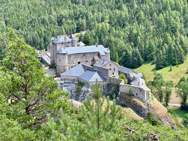
Day 4 : La Chalp d'Arvieux (1750 m) – Lac de Roue (1850 m) – Chateau Queyras (1350 m) – Old Town (1400 m)
Elevation gain: 150 m / Elevation loss: 800 m / Distance: 9 km / Walking time: 5 h
Leave La Chalp via the GR 5 towards Lac de Roue. The climb begins in the undergrowth, then the balcony path leads you to the hamlet of Les Maisons. Take the track rather than the path; the climb will be more gradual to reach Lac de Roue. Continue on the GR5 which descends to Château-Queyras. When you reach the road, cross it and turn right at the traffic lights. Pass below Fort Queyras, perched on an ancient glacial barrier, then follow the Guil River to Ville-Vieille.
Accommodation at the Astragales lodge which will show you a location to put the donkeys.
Day 5 : Old Town (1400 m) - Aiguilles (1450 m) – Abriès (1550 m)
Elevation gain : +300 m / Elevation loss: -180 m
Distance: 10.1 km / Walking time: 4 h
Take the road towards Molines Saint-Véran for 300m then at the bend take the path that goes opposite. It joins a forest track that leads to Aiguilles. Cross the village and take the Pas de l'Ours or the forest tracks of Peynin and Marassan (adds 300m of D+/D-) Follow the Guil to the village of Abriès. Accommodation at the Edelweiss or Ancolie Bleue lodge.
Day 6 : Abriès (1550 m) – Le Roux (1760 m)
Elevation gain: 560 m / Elevation loss: 350 m
Distance: 10.3 km / Walking time: 5 h
Follow the Guil towards Ristolas. In the village, cross the Guil at the first bridge and you will find on the left the path that climbs towards the Moussou pond . Continue to the Aiguiller belvedere, the view is magnificent on the Mont Viso (3841m). Arrived at the chairlift, take the Ponsole track . At the Marius pond ( hill reserve ) continue to the left. The track spans the Bouchet torrent and to the left, takes you back to the foot of the Roux. One last climb and there you are!
- Practical information -
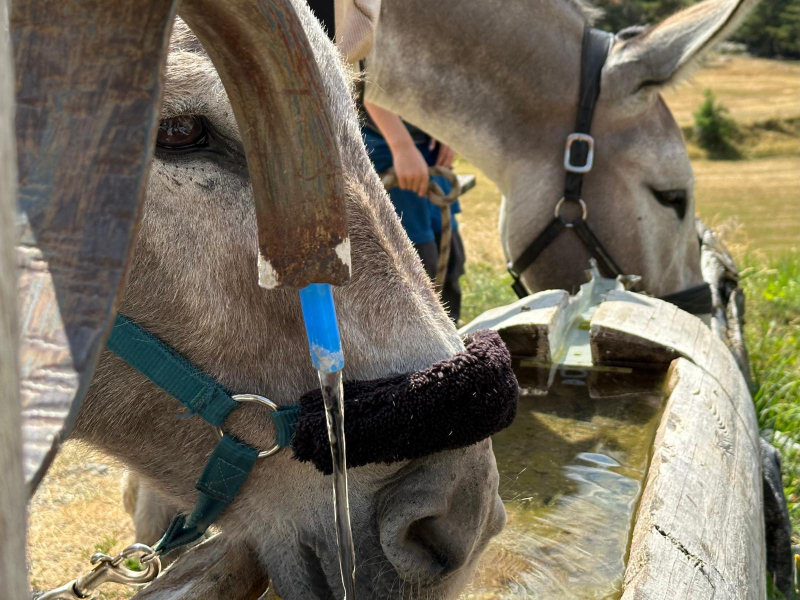
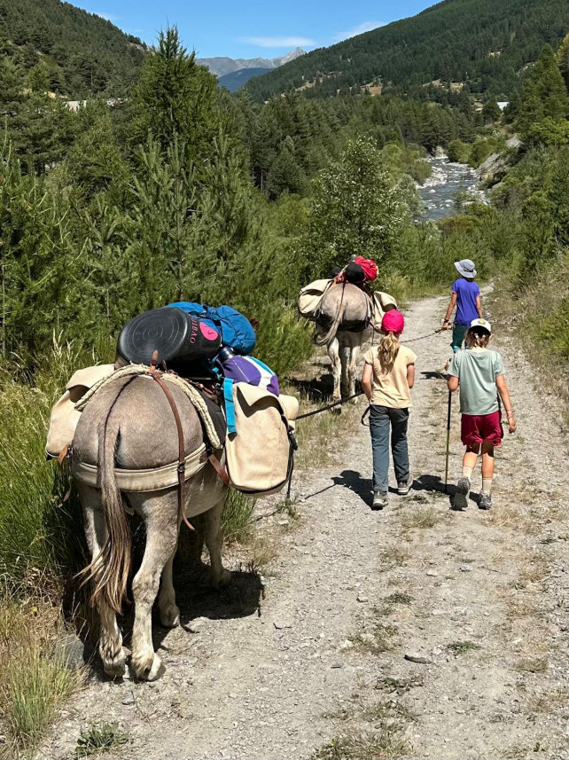
The donkeys
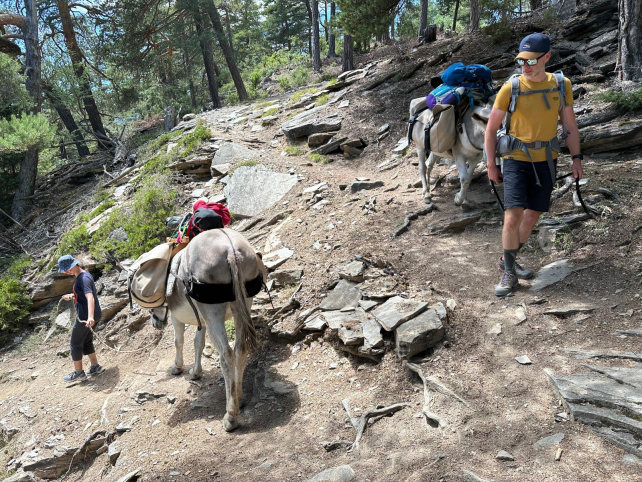
* They are intended to carry your luggage. Gregarious animals, they will appreciate your company but also that of their fellows and beyond 3 people, it would be better to travel with 2 donkeys for the comfort and well-being of all.
* Their equipment : Each donkey is equipped with a halter, a lunge, a wooden packsaddle and 2 large bags hung on each side of the packsaddle. A donkey can carry 30 kg, that is the luggage of 2 to 3 hikers.
The load must be perfectly balanced (20 kg on each side). Above the animal, only light loads (mattresses, etc.) can be placed, in order to avoid exhausting or unbalancing it.
* Donkey food and night : in most lodges, a park is set up for donkeys and we provide the necessary equipment to tie them up at night.
Preparation for your hike
We advise you to arrive at Le Roux the day before your departure in order to get to know and prepare your hike (study of the route). Accommodation is possible at the Cassu gite, opposite our base camp.
On the morning of departure, allow at least one hour for the preparation of the donkey and the organization of luggage.
Period
This hike can be done from July to October.
IGN map
This circuit appears on the IGN maps (1/ 25000th ) 3637OT - Mont Viso, St Véran , Aiguilles, Queyras and 3537ET- Guillestre, Vars, Risoul, PNR du Queyras
Accommodation
This hike was designed for accommodation in lodges.
The refueling
For water, bring one bottle per person and a filter.
Grocery stores in Abriès, Aiguilles, Old Town.
Needle Pharmacy.
Your luggage
In the Hautes-Alpes the climate is very contrasted: the heat of full sun during the day and surprising freshness at night.
So plan :
* walking shoes and light shoes for the evening,
* a change of clothes, a warm sweater, a hat for the sun,
* rainwear (waterproof poncho),
* water bottle, flashlight, notebook, pen, lighter, knife, string,
* pharmacy, protective cream and sunglasses,
* plastic bags to wrap the things in the bag (very effective in case of rain) and to bring your trash down,
* stove and kitchen equipment, tent and sleeping bag (if camping)
Your dog
According to regulations, your dog can accompany you on the trails of the Queyras Regional Natural Park provided that it is kept on a leash. After a period of adaptation and mutual observation, he will cohabit with the donkeys. However, it must be taken into account that this does not simplify the organization of your hike because it is sometimes difficult to manage everything at the same time: the donkey or donkeys, the children, the luggage, the map to follow the right path and... the dog ! Especially since it is sometimes necessary to keep away from the donkey with the dog on a leash and that there can be problems with the dogs that protect the flocks of sheep in the pastures. Dogs cannot sleep in the accommodation and, in general, a shelter is provided for them outside. Remember to let us know if you plan to hike with a dog.
Your car and various equipment
During your hike, your car stays in one of the car parks in the hamlet of Roux d'Abriès.
- Prices and contact -
It includes the rental of a donkey equipped with a packsaddle, a halter, a lunge and two saddlebags.
Your accommodation and the possible transport of donkeys must be paid in addition.
6 days with 1 donkey : € 372
For more information :
06 82 48 09 99 or anerousin@orange.fr
To book this stay, please download and complete our rental contract and attach a deposit of 30% of the amount.
Download a printable version of this hike (Pdf)